![]()
Possible hex conversion methods.
Here are the different methods i have developped to convert a map from one scale to another (smaller).The opposite would really be hard to do.You'll see why.
ps: remember that in order to get a north orientation with grid you have to draw your maps sideway and then once extruded rotate them 90 degrees conterclockwise.So on the small drawings beneath the north is actually on the right of the page.
1-How to convert a 72 miles hex in seven 24 miles hex.( or from a 24 miles hex to 8 miles hexes)
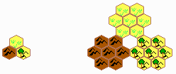
The remaining blank hex in the middle should then be chosen in accordance with the general appearence of the terrain.
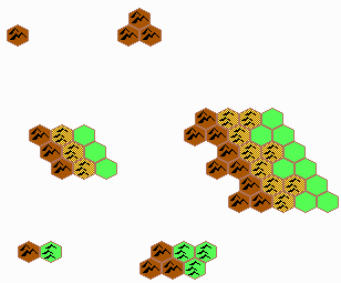
2 - How to pass from a 48 miles hex to 24 miles hexes. (just a thought , it produces slight discrepencies but so far i have not been able to find a better way).
3 - How to pass from a 48 miles hex to 8 miles hexes.
I 've different methods.
#1. 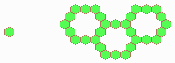
Of course then the interior hexes would have to be filled with similar hexes and the borders would be split according to the surounding hexes..
#2. 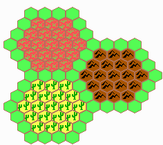 becomes
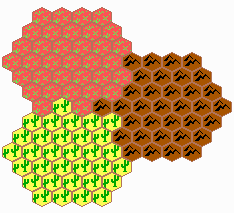
The borders have to be split according to the terrain. Note also that there has been a slight rotation in the process (30 degrees).
It sould be taken into account when rotating the all map to get the good orientation.
pb : someone who wants to cross from one border to the opposite border on the other side would have to walk 7 by 8 miles = 56 miles. the solutuion might be to say that the smaller hex are nox 7 miles hexes and the discrepancy would be only 1 miles.
but if we look at the discrepency the following way: The difference is 8 miles between what we expected and what we got.So the avarage difference is 8miles difference divided by 7 hexes= 0.875 miles (or 10% error by hex). I think that this is acceptable.the accuracy of the maps in the medieval times were not that high.
Conclusion: Please do not draw in 48 miles per hex.This scale really sucks. I personnaly curse the one who drew the map in WotI using this scale.Next time think about the consequence buddy.
Note: there are big discrepencies between the official maps detailing the Heldannic regions.(X11, WotI, PWA, DotE).
The distance Landfall-Freiburg is very relative and changes a lot from one map to the other.the denagothian plateau has not been mapped other than in X11.The big 72 miles per hex map from DotE does't fit the description in X11.
You are now warned.
I hope this will help many of you.
![]()