Lining Up Mystara I
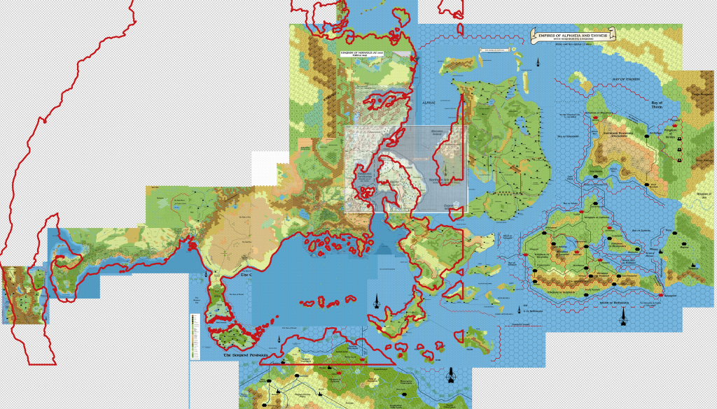
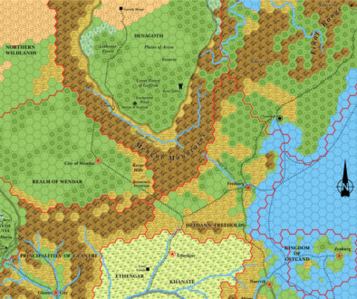
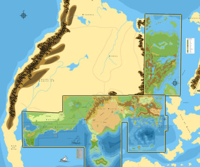
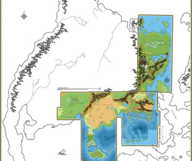
In this series of posts, I’m going to work through all of Mystara’s overland maps, connecting them up and resolving problems. Also responding to feedback from the community and adjusting as necessary. The end result will be a coherent set of maps that fix the respective locations of all the land masses on Mystara, as well as locking in latitudes and longitudes, global dimensions, and the exact location and composition of the polar lips between the Outer and Hollow Worlds. This will enable the georeferencing of Mystara, which opens up lots of fun possibilities for future maps.
First let’s take stock of the known issues. Resolved issues will be struck off with links to relevant articles as we cover them.
How 8 mile per hex maps interlock with 24 mile per hex maps:Known World/Great Waste(Lining Up Mystara II)Great Waste/Gulf of Hule(Mystara Reborn post)Serpent Peninsula(Lining Up Mystara III)Orc’s Head Peninsula(Mystara Mapping Issues, Orc’s Head Peninsula and Trident Bay, Savage Coast Trail Map)Isle of Dawn(Lining Up Mystara III)
How 24 mile per hex maps interlock with each other:Known World/Great Waste(Lining Up Mystara II)Great Waste/Hule(Lining Up Mystara III; for link with 8 mile per hex maps, see Mystara Reborn post; also see Piazza post about Great Escarpment)Isle of Dawn/Alphatia(Lining Up Mystara III)Isle of Dawn/Ochalea(Lining Up Mystara III)Isle of Dawn/Pearl Islands(Lining Up Mystara III)Isle of Dawn/Alatian Islands(Lining Up Mystara III)Norwold/Known World & Northlands(Lining Up Mystara VII)Davania(Lining Up Mystara XII)
How 24 mile per hex maps interlock with 72 mile per hex maps:Known World, Isle of Dawn, Alphatia, Ochalea & Pearl Islands, Alatians, Serpent Peninsula(obsolete; use 24 mile per hex maps)Alphatia/Bellissaria/Esterhold(Lining Up Mystara IV, Lining Up Mystara V)Davania(Lining Up Mystara XII)Norwold(Lining Up Mystara VII)
How 72 mile per hex maps interlock with each other:Overall(Lining Up Mystara V)Davania(Lining Up Mystara XII)
How the world map lines up with the hex maps(Lining Up Mystara XI, Lining Up Mystara XII, Lining Up Mystara XV, Lining Up Mystara XVI, Lining Up Mystara XVII, Lining Up Mystara XVIII)Latitudes(Lining Up Mystara IX, Lining Up Mystara X, Lining Up Mystara XIII, Lining Up Mystara XIV)Position of equator(Lining Up Mystara XII, Lining Up Mystara XIII, Lining Up Mystara XIV)- Exact latitudes of major cities (Lining Up Mystara XII, Lining Up Mystara XIII, Lining Up Mystara XIV)
- Definition of latitude on Mystara (Lining Up Mystara XIV)
- Longitudes
Axial Tilt(Axial Tilt thread at The Piazza, Lining Up Mystara IX)- Polar Openings
Location of start of Polar Lip(Lining Up Mystara IX, Lining Up Mystara X)- Latitude within the Polar Openings (Lining Up Mystara XIV)
What land falls within the Polar Openings(Lining Up Mystara IX, Lining Up Mystara X, Lining Up Mystara XIII, Lining Up Mystara XIV, Lining Up Mystara XV, Lining Up Mystara XVI, Lining Up Mystara XVII)- How to map these regions
Global dimensions(Lining Up Mystara XIII, Lining Up Mystara XIV, Lining Up Mystara XIX)Hollow World: (Lining Up Mystara XIII)How Iciria’s 40 mile per hex map corresponds to the Hollow World map(Lining Up Mystara XVI, Lining Up Mystara XVII)- Georeferencing the Hollow World
Did I leave anything out? Some of these are already resolved, or very nearly resolved. But I’d like to publicise my thinking behind each one, so I’ve included them all in the list. The only thing I’m really leaving out is how the 8 mile hex interlock with each other, which I think is mostly already resolved — the Known World by TM1 and TM2 trail maps; the Savage Coast by Red Steel’s poster maps.
Let me know if you can think of any other issues to add to this list.
3rd February 2016 Update
The list is slowly being whittled down, and the project is nearing completion. It’s been a very productive time, but the repercussions of all of these decisions will take a lot longer to process and incorporate into the maps.
In the midst of this project, I have launched a new site for the Atlas of Mystara project, which has taken up a lot of time. This, of course, is where the eventual results of this Lining Up Mystara project will be published.
I stated in various places that I would wind up this project by mid-February, and I think we’re on schedule to do that. I guess what I’m trying to say is that the fallout from all of these articles is likely going to take a long time — many more months or years, in all likelihood — to deal with. I’ve already started doing this, but it’s beyond the scope of the present project, and I need to concentrate my attention on that for now.
To put it more succinctly: this project deals with the major issues of Mystaran cartography, but the nitty gritty details will remain, to be dealt with after this project is finished.


Lining Up Mystara II – Thorfinn Tait Cartography
28 December 2015 @ 6:18 pm
[…] Time to deal with the first few issues on the list in the first post of this series. […]
28 December 2015 @ 7:33 pm
Is there a “Lining Up Mystara” topic over at The Piazza yet?
I checked the main Mystara forum and the Thorf’s Projects subforum, but didn’t spot anything.
Is it posted with another name…or somewhere else?
28 December 2015 @ 10:10 pm
There is indeed! It’s not a new thread, but rather the continuation of an older thread. I’ve been posting updates there periodically. It’s one of the main places I’m hoping to get feedback from the community on these issues.
http://www.thepiazza.org.uk/bb/viewtopic.php?f=22&t=10232
30 December 2015 @ 4:46 am
Awesome idea, and a Sh*tload of work I imagine.
Respect
31 December 2015 @ 6:28 pm
Hi Thorf, this is a majestic project indeed! I also think that if there is someine able to perform such a task, this is you.
I’d add another issue to your list, which is the wrong vertical scale of the western portion of Davania as mapped in PWAII maps. According to these maps, due to a mistake in taking the right location of the equator, the Addakian mountains are moved too much to the north and all the geography in between up to the northern coast is “compressed”.
2018 Mystara Project Updates – Thorfinn Tait Cartography
8 January 2018 @ 3:39 am
[…] have begun work on codifying my Lining Up Mystara project. After finishing it almost two years ago, I haven’t had time to work on it much more, […]
Mystara Climate Maps – Thorfinn Tait Cartography
20 January 2018 @ 11:37 pm
[…] the meantime, I decided to move ahead with assembling the coastlines resulting from my Lining Up Mystara project. This is obviously an essential step in making the hex maps, but also in constructing a new […]
Jurassic Earth as Mystara – Thorfinn Tait Cartography
13 June 2019 @ 8:27 pm
[…] solution, as outlined two years ago in my Lining Up Mystara project, is to treat all of the maps as if they are Equirectangular projections. The reasons for […]
13 August 2019 @ 6:31 pm
I am sure you are aware of the following, but as I see no reference to the info I will point it out, just in case. The maps in X1,4,5,6,9 and CM1 and M5 and Dungeon 6 & 7 all matched up fine in 24 miles scale. X11 contradicted CM1 and ‘misdrew’ parts of X1. Dawn of the Emperors was where Isle of Dawn was stretched, presumeably to better conform with the contimnental view maps in Companion and Master rules. However, parts of the 2 black and white inernal islands maps only varied from M5’s in part. I lack the skills to do what you do but it would be lovely to see the combined “first” version of the world maps in 24miles per hex from all the sources in the my 2nd sentence above. In the nineties I made a handrawn map of the confluence of x1, x11 nd cm1. If I can, I will post it to you. I am not expecting you will use it but I would be interested in hearing your feedback. What is the best way for me to send a scan of my handrawn map.
Also, it occured to me that most people would prefer their own customisations of the areas not covered by canon maps. When you complete your map, will there be a “blank” version with all the terrain but no cities, roads borders etc. for the areas not covered by the cannon maps. If so that would be a dream come true for me as I never will be able to make such a map, but have dreamed of one since the eighties. With the terrain only, people can use whatever cultures and civilisations and border and settlements that they like.
Anyway, just some personal thoughts.
I admire your work! It’s simply wonderful!
21 October 2019 @ 10:00 am
Thank you very much for the detailed feedback! It’s much appreciated. 🙂 Apologies for the lateness of my reply.
I would love to see your hand-drawn map! Why don’t you post it at The Piazza? I’m sure there are lots of people there who would be interested, myself included.
By the way, have you seen my more recent Let’s Map Mystara articles? I have been finding that in fact the 24 mile per hex maps don’t fit together nearly as well as I once thought. If you just line up the maps using hexes, of course they will roughly fit, but if you do this while referencing the continental and world maps, things become a lot muddier.
For example, CM1’s Norwold is differently-aligned to the rest of the Known World; X9’s Savage Coast is at a different angle, and in fact enlarged; etc. These are things that can’t easily be reconciled without computer processing, but it’s not that hard with today’s technology.
Let’s Map Mystara aims to reinterpret the whole set of maps, allowing them to be placed together through adjusted scales and rotations while maintaining the internal integrity of each map. This should result in a set of coherent maps, but without rubbishing any of the source maps along the way — except where they conflict with each other in content, such as your CM1/X11 example.
I’ve only just begun examining the Isle of Dawn. I hadn’t realised before quite how messy it was. My initial findings chime with your assessment here: it seems like they enlarged it deliberately, while maintaining much of the detail of M5’s design. My worry is with how it fits with the continental map, and I suspect it’s going to be really hard to sort it out — especially when part of it appears on the trail maps at 8 miles per hex.
Finally, yes a blank set of maps is absolutely among my plans. 🙂 In the meantime I am happy to provide individual blank maps of existing maps upon request.