
Denizens of Denagoth
by JTRHere is a 8mph map of the Denagothian region. The sources for the map include:
- X11: the 24mph map was used to set all contours for the plateau, with 12, 6, and 4 mph interior maps used to detail Geron, Geffron, and Lothenar, respectively.
- Thorfinn Tait's 8mph Wendar
- WOTI large maps, and CM1 with the terrain information being feathered together (See below)
- Geoff Gander's Northern Wildlands map and his older 1997 map of the plateau
- Andrew Theisen's placement of Barony Two-Lakes
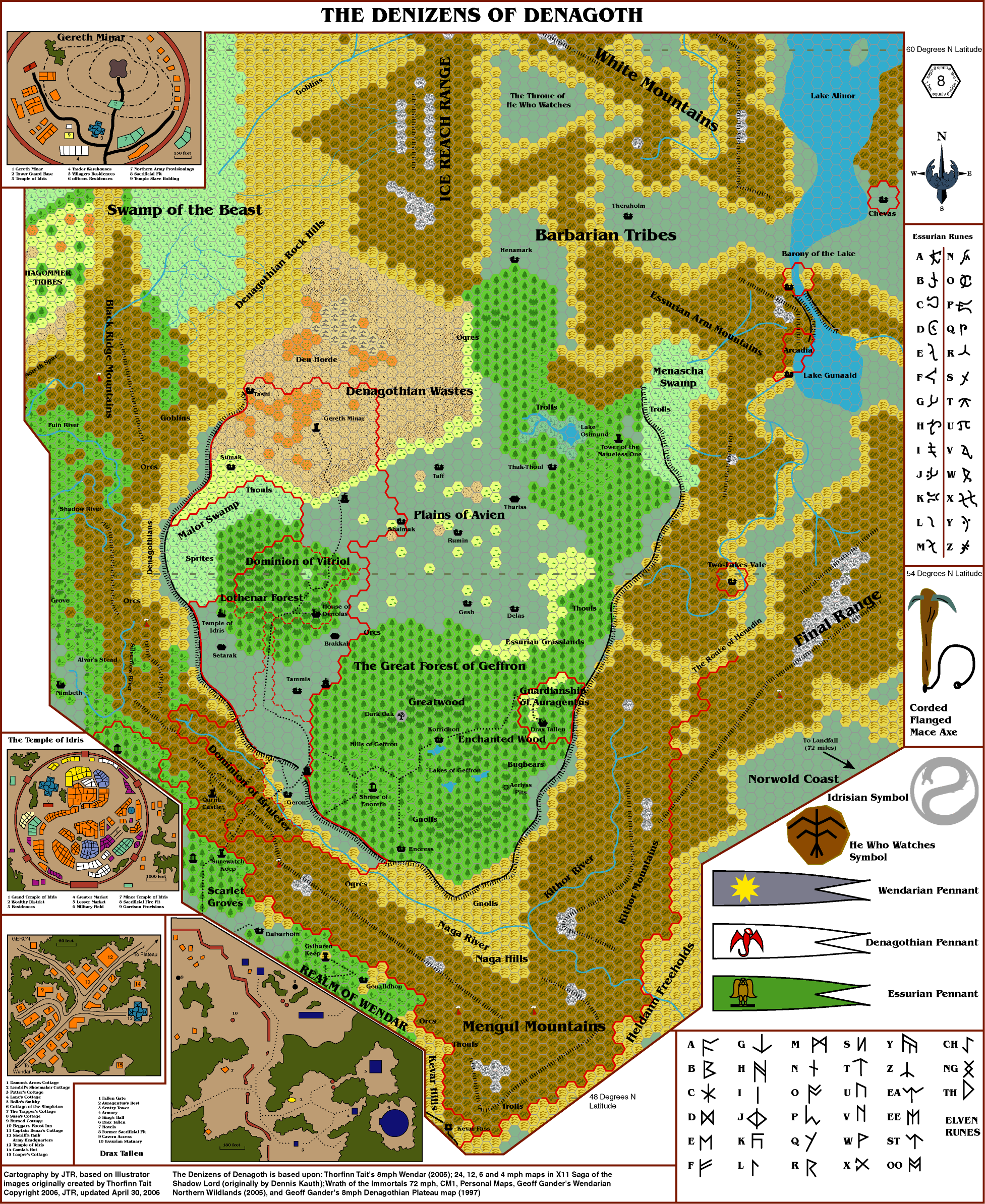
The key problem with fitting Denagoth is the eastern Mengul Range and the conflicting information with CM1 and later large projects. To mesh them, I placed the ribbon of clear terrain within the southwest mountains of CM1 as a narrow path in the Menguls and used the triangular clear region abutting the Ice Reach mountains as land just north of the Plateau region between the old desert and the northern Geffron forest.
The regions meshed very well, with no lose of any plateau detail.