
2300BC Demhyeld river
by RobinIn the Thread you mention this particular river is not mentioned, nor can I trace it on Thorf's excellent and useful map
Trying to merge all information canon and then fanon into one single source is hard, and regularly seems to contradict or even be geomorphological impossible. hence this question.
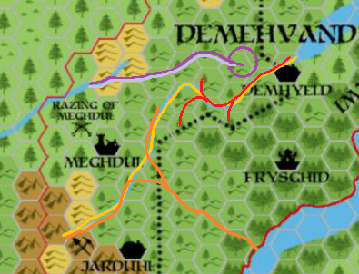
The river I meant on the 2300BC map I colored Yellow here
the light purple line is the 1000AC canon river as on the RC/gaz and boxed set maps.
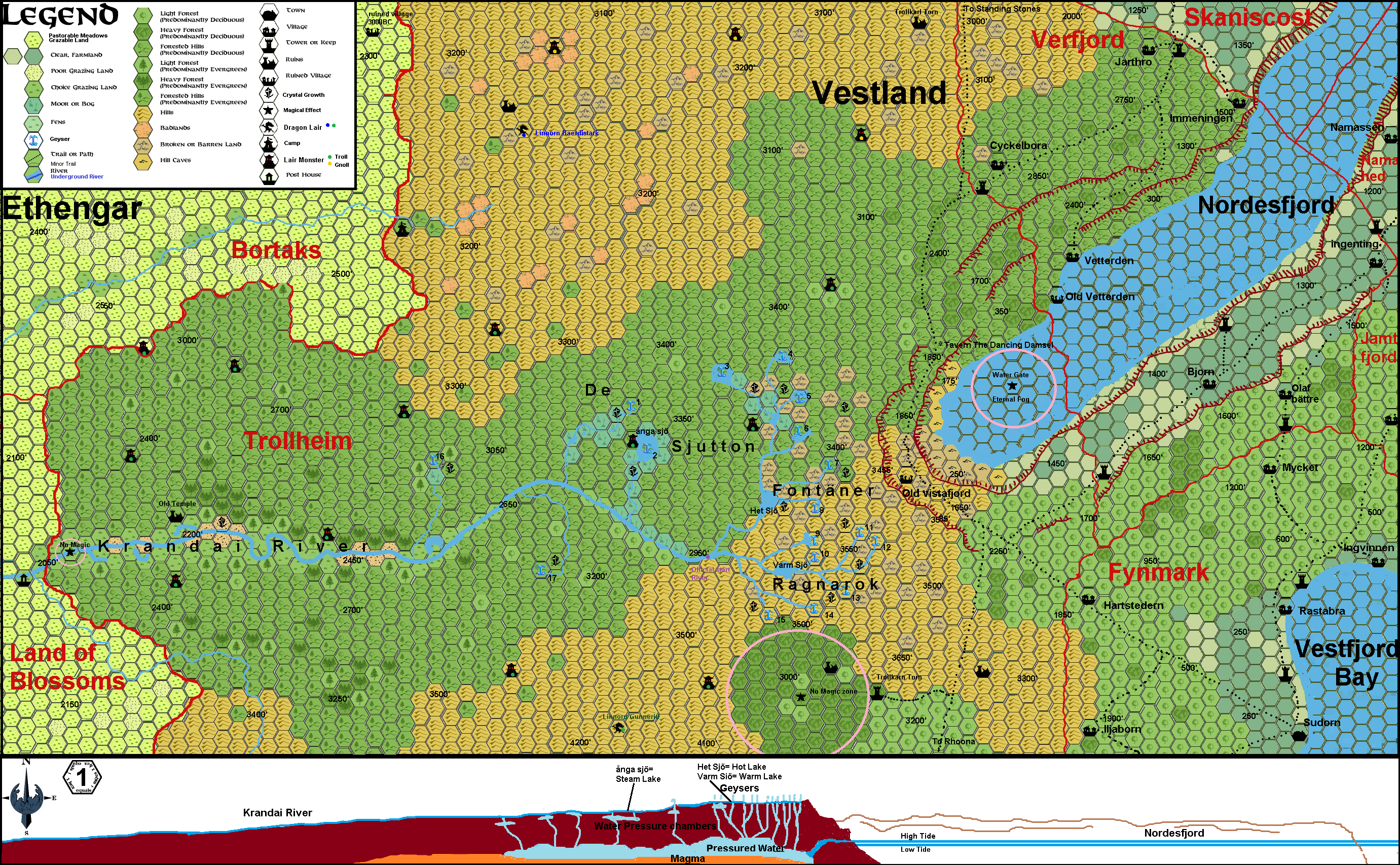
The purple Line and circle is my earlier 1000AC creation of this particular source, giving it a logical reason to exist there.The circle are the geysers and Krandai Source see this map
The Orange and Red Lines are my 1000AC suggestions as mentionen in the post above; where the Red line river section will "die" after the Plateaux rises in 1700BC. this red line will have several sources (possibly also geothermal, but not as intense as the Krandai will have in 1000AC)
This seems to be the only plausible solution, as far as I can see, while maintining all sources and geomorphology/flow patterns.