
Ethengar Blackmoor Era
by Robin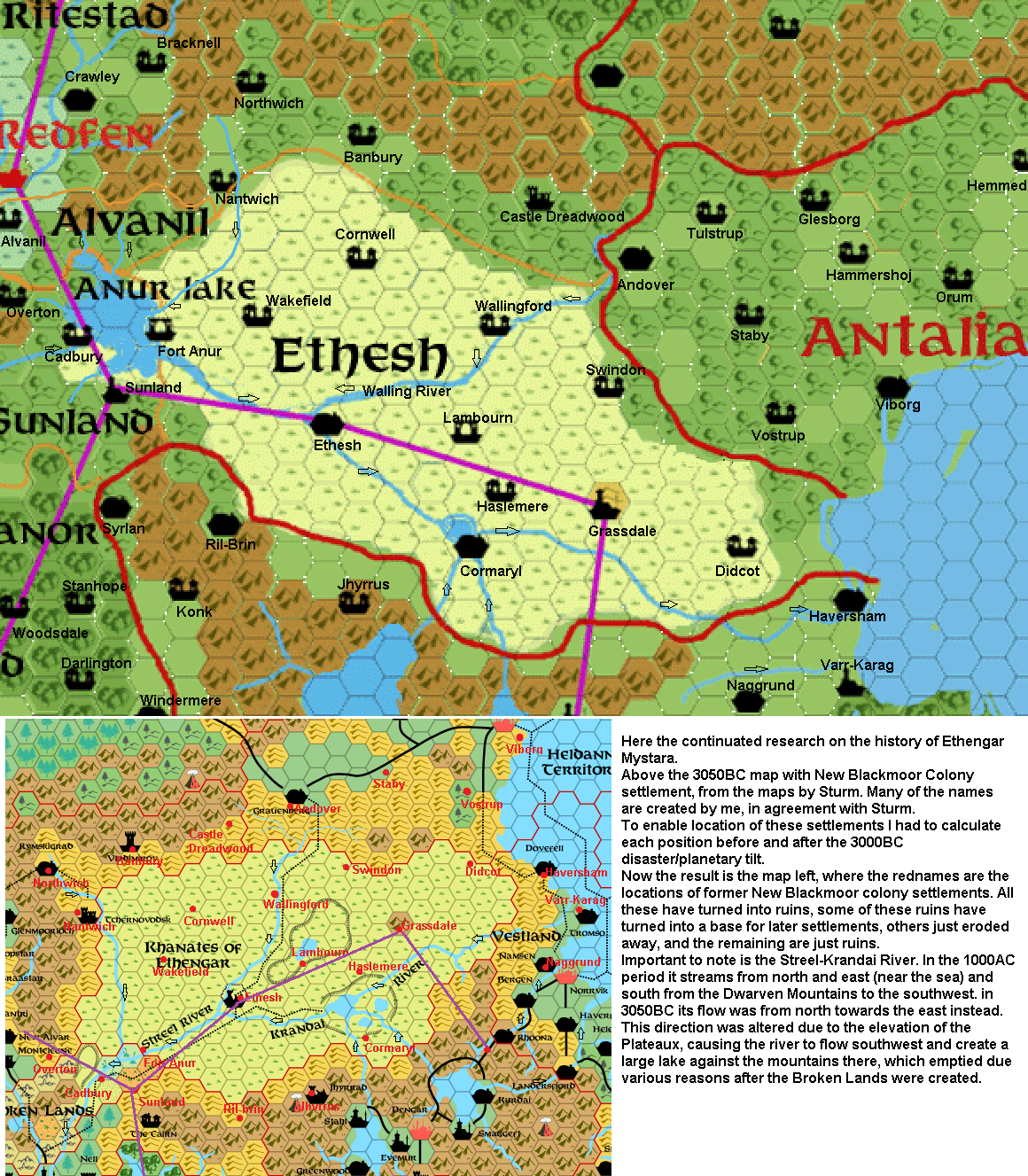
Here the continuated research on the history of Ethengar Mystara.
Above the 3050BC map with New Blackmoor Colony settlement, from the maps by Sturm. Many of the names are created by me, in agreement with Sturm.
To enable location of these settlements I had to calculate each position before and after the 3000BC disaster/planetary tilt.
Now the result is the map left, where the rednames are the locations of former New Blackmoor colony settlements. All these have turned into ruins, some of these ruins have turned into a base for later settlements, others just eroded away, and the remaining are just ruins.
Important to note is the Streel-Krandai River. In the 1000AC period it streams from north and east (near the sea) and south from the Dwarven Mountains to the southwest. in 3050BC its flow was from north towards the east instead. This direction was altered due to the elevation of the Plateaux, causing the river to flow southwest and create a large lake against the mountains there, which emptied due various reasons after the Broken Lands were created.