
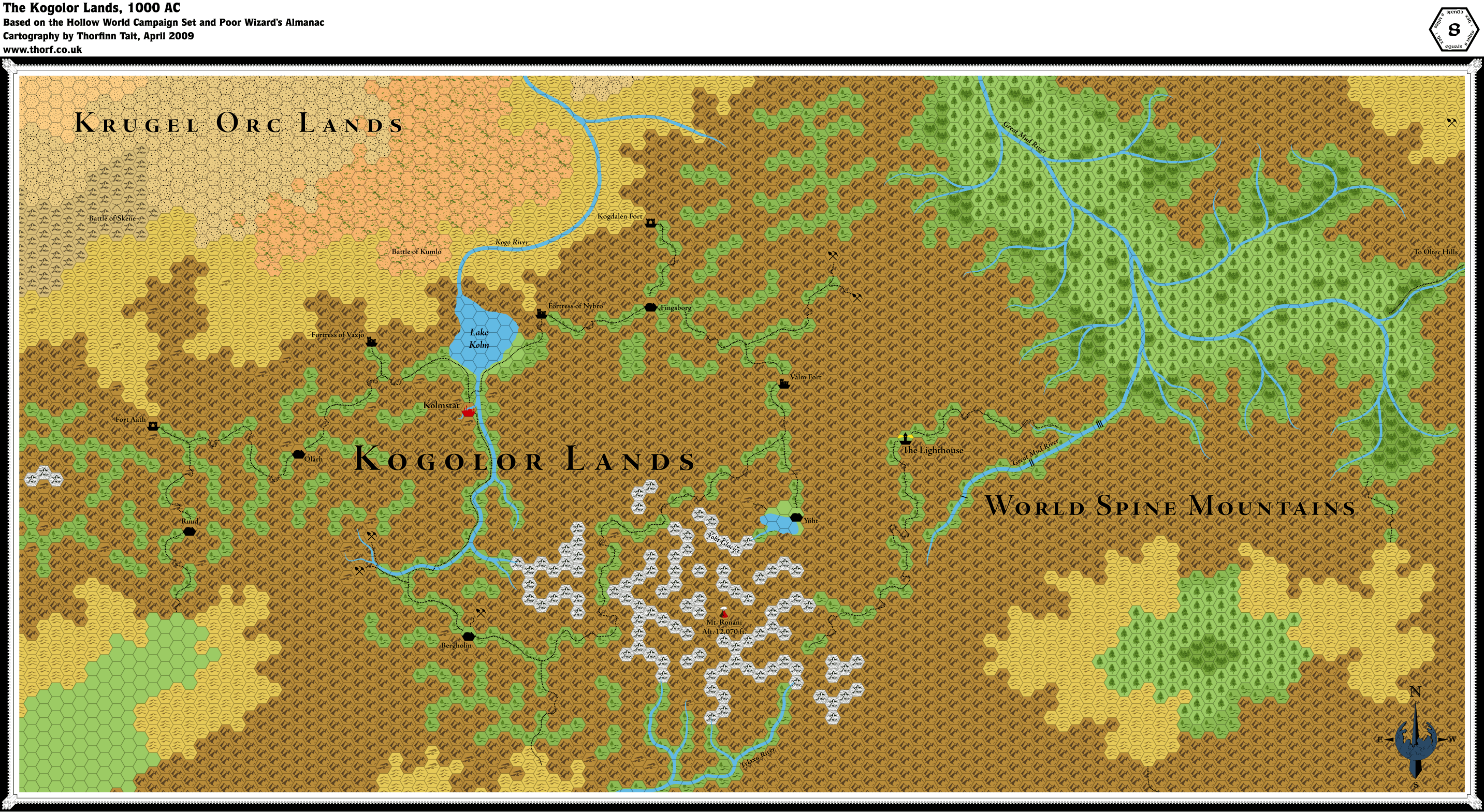
Kogolor Lands, 8 miles per hex
by Thorfinn TaitMaps
Updated map of the Kogolor Lands, 8 miles per hex by Thorf, April 2009
Comments
This map is based on the 40 mile per hex Iciria map, as well as official text sources. Unfortunately there is very little information on the Kogolor Dwarves to work with, but I will be developing the map by extrapolating new settlements and locations in the spirit of the scant official information we do have.
I'm still considering how to label these maps, but it seems likely that I will create two versions: the first is the undeveloped map, based 100% on official sources; the second with my own extrapolated details will be presented as an unofficial variant.
Sources: Hollow World Campaign Set (1990), Poor Wizard's Almanac (1992).
Notes on XXX
To Do List
Finish filling in the base terrain.- Add details to the mountains - valleys, caves, the occasional glacier, etc.
- Add minor rivers and trails.
- Add villages and some more towns. Possibly also more mines and a few more battlefields.
References
- The Great Mud River mountain valley - discussion thread at the Wizards of the Coast boards.
Thanks to: