
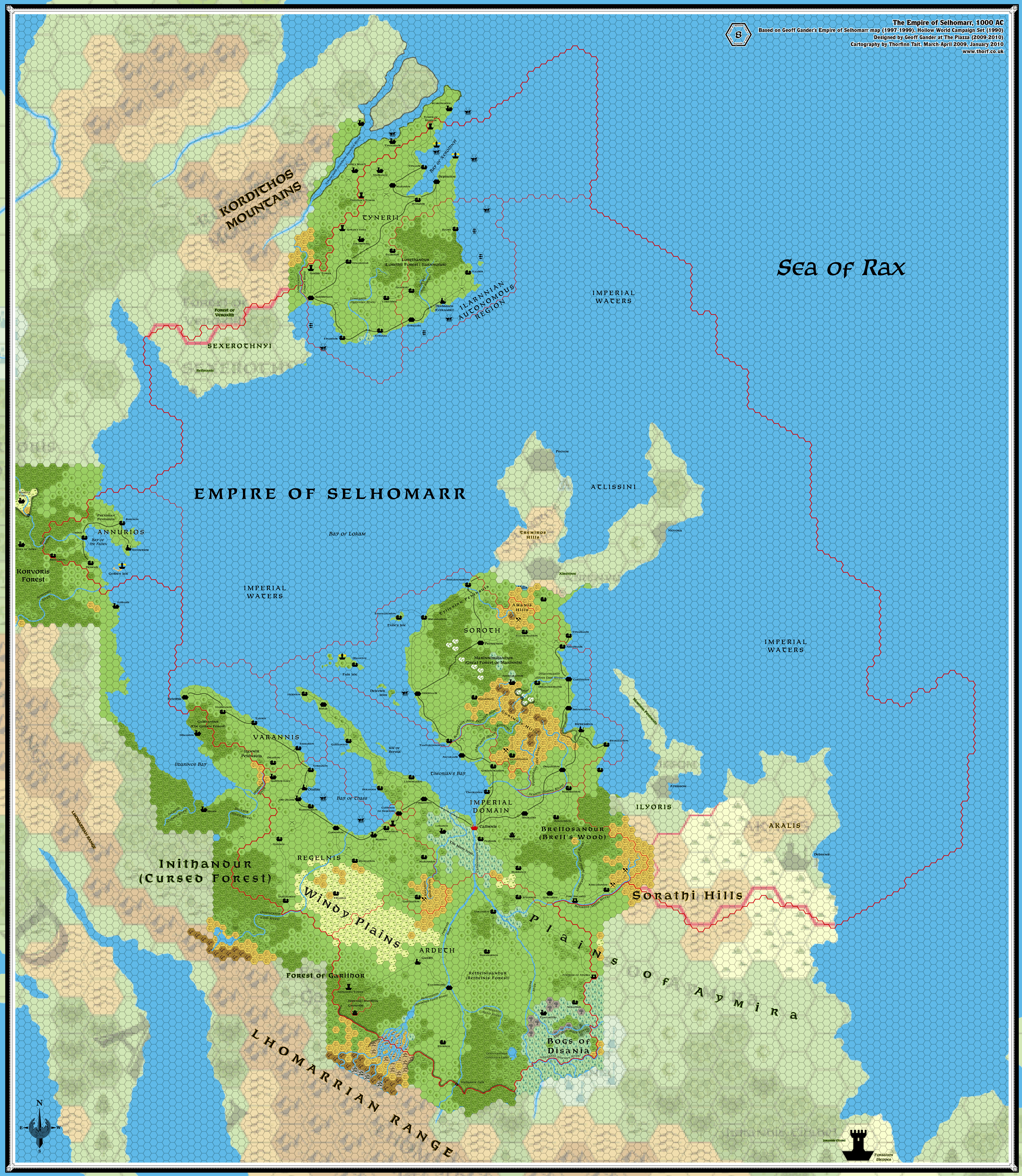
Selhomarr, 8 miles per hex
by Thorfinn TaitMaps
Map of Selhomarr, 8 miles per hex by Thorf, March-April 2009, January 2010 (Work In Progress)


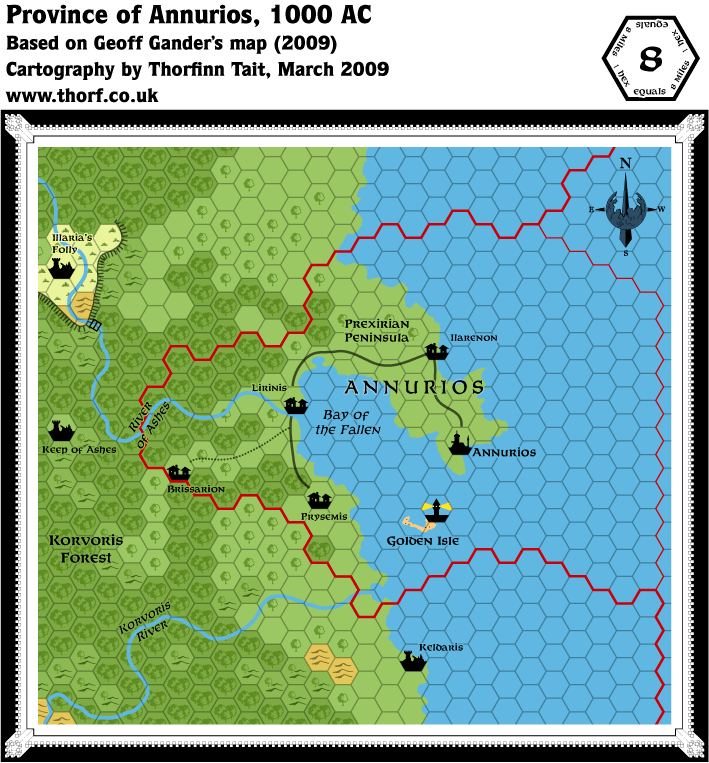
Province of Annurios, 8 miles per hex by Thorf, March 2009


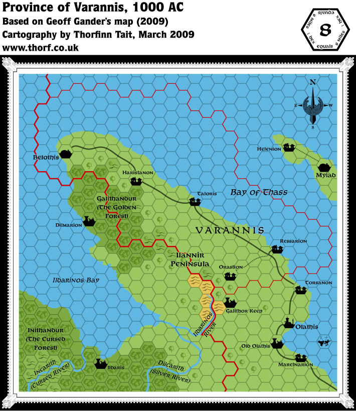
Province of Varannis, 8 miles per hex by Thorf, March 2009
Comments
This thread is for working on an 8 mile per hex version of the Empire of Selhomarr.
Sources: The Empire of Selhomarr (1997-1999) by Geoff Gander, Hollow World Campaign Set (1990), Selhomarr, 40 miles per hex (2009).
Notes on The Empire of Selhomarr Gazetteer
- Places to add - Arstina (town – near Heressina)
Pergamnos (village – Calimnis)
Pesinnir (10 mi. south of Calimnis)
Prallis (far north)
Xerathnis (village - Ardeth)
Jurandis’ Citadel (Forsaken Steppes)
Thorf's To Do List
- Fill in the base terrain.
- Adjust the captions to fit the new scale.
Redraw the rivers (they're currently part of the coastline shapes, and as a result far too wide).- Place the settlements.
- Trace the borders from the small scale map. (This is my least favourite part of making a hex map...)
- Add some detail to the coastlines and rivers.
- Add Geoff's latest changes.
Geoff's To Do List
- Name the peninsula on which Myiad is located.
- Name a bunch of bays (
at least 4at least 3). - Name the river north of Bay of Xerothnyi.
- Name the grasslands shared by Regelnis and Ardeth.
- Search the Gazetteer for other place & geographic names and note them for inclusion.
References
- Selhomarr section in the Atlas at the Vaults of Pandius
- Selhomarr, 40 miles per hex - thread for the original Selhomarr map at the Piazza
Thanks to: