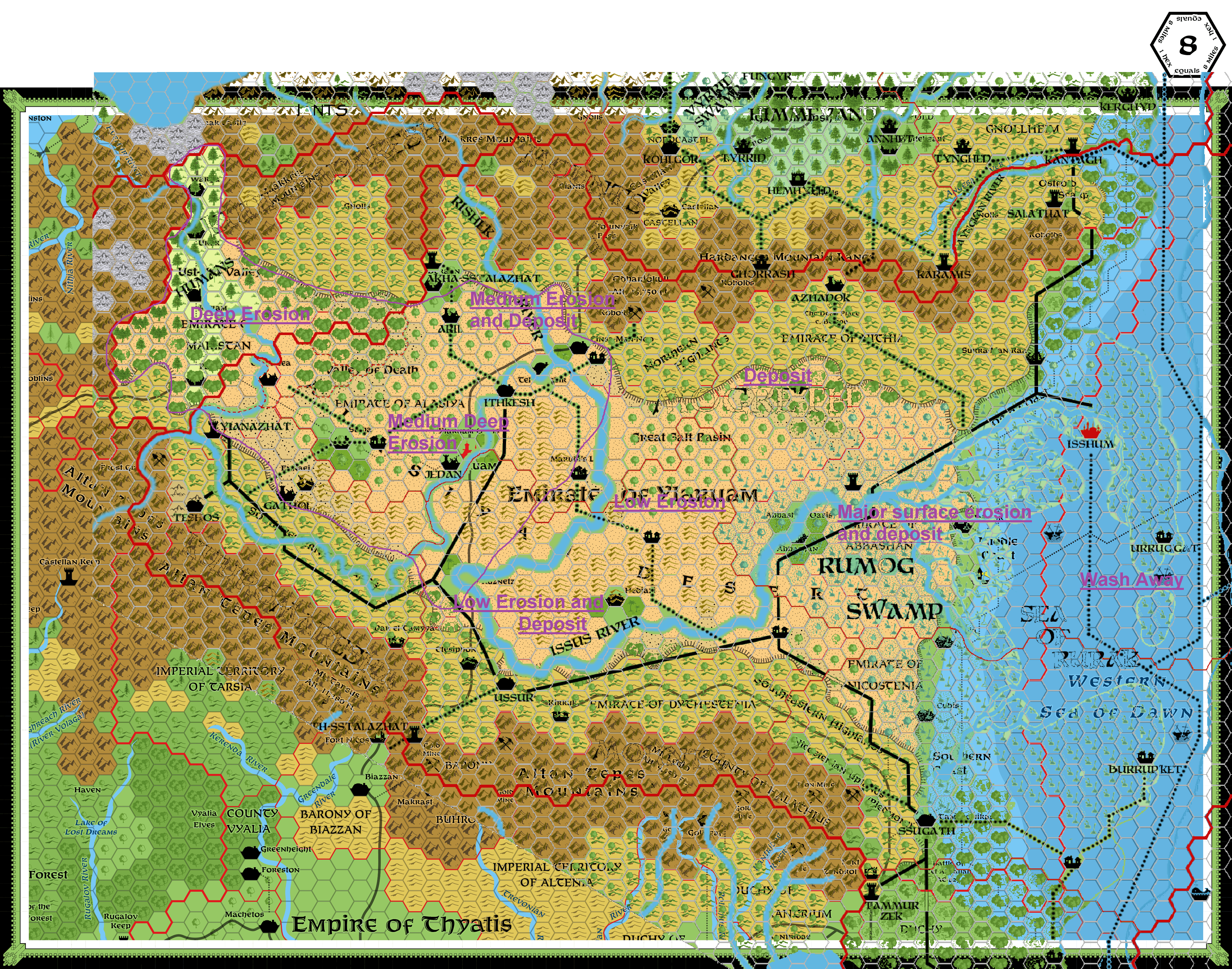
River flow Mogreth/Ylaruam comparison
by RobinOk to make an attempt to clarify the great differences between the river flow in the Mogreth era and the later region I made this overlay of Mogreth Maps (here and here) and the canon (by Thorf) map of Ylaruam
It reveals major differences and clarifies erosion due the tidalwave causing the destruction of the Mogreth Empire and hence the major change of the region which hereafter became Nithia (and much later Ylaruam)
It also reveals surviving locations where Mogreth Ruins could be found.
And it reveals the minor mapping differences between Chimpman's earlier Nithia and My version of Nithia in 500BC, which are resolvable(when I am going to map Ylaruam--which will certainly take a while)
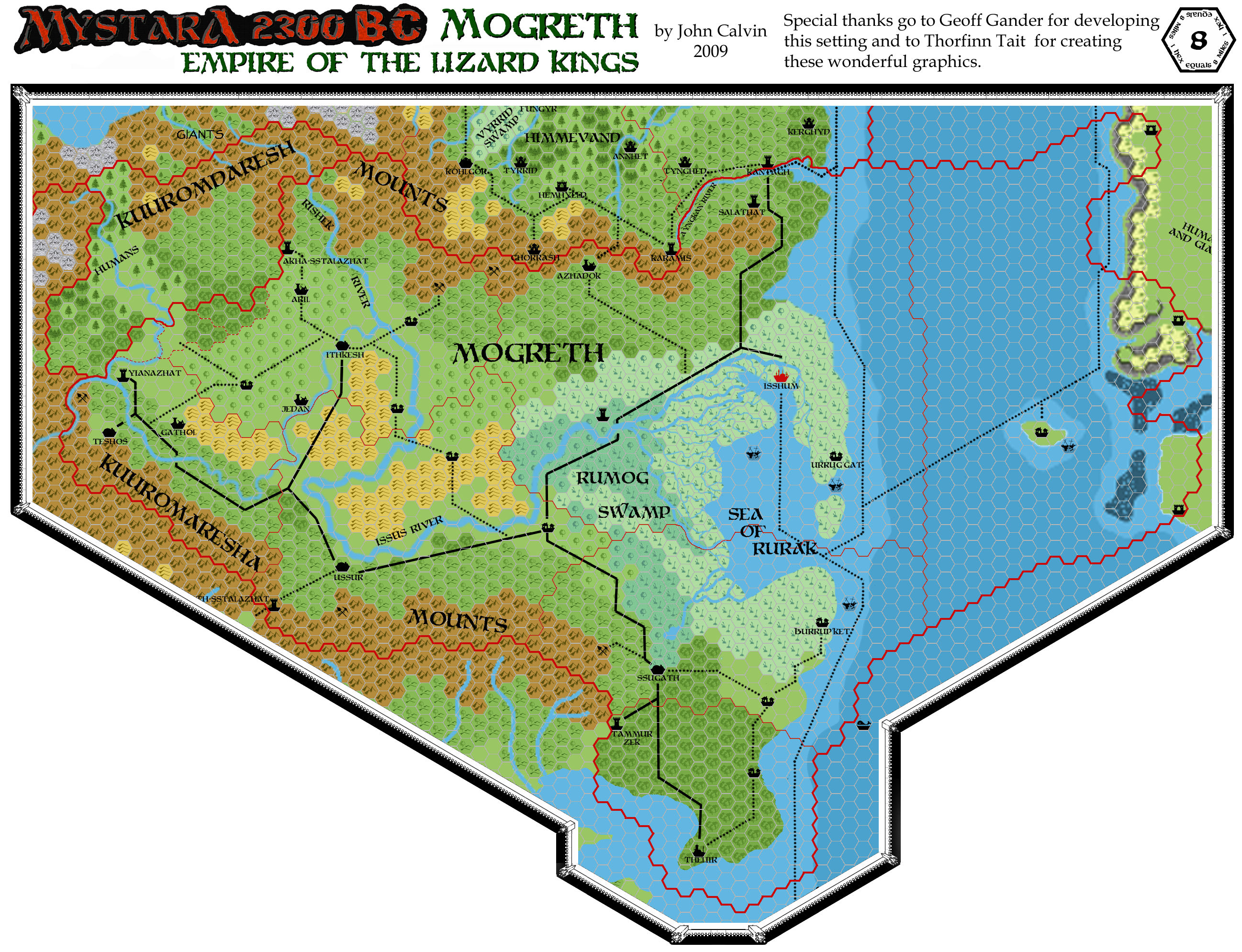
I have to do a second overlay for Nithia yet doing it on this map would make a mess.
So I will have to make that one seperately...later
As I require the South-Western section partially on my Karameikos North 1 mile Hex map I have to do this now.
I already imposed Simone Neri's and Shawn Stanley's regional map information as well as Agathokles' information on that section of the map
The provlem lies up to now mostly with the mogreth town Teshos and the Nithian City Iunyt accordingly. They are soo close, that it is uncertain if they use the same location or not. I prefer not, as it would give way more area details and adventure locations, yet still the uncertainty remains.