
Northern Wildlands Map
by LoZompatore.If you like, here you are a map of the Northern Wildlands/Denagoth/Wendar region I drew for the Italian Message Board, in a 24 miles/hex scale. It is based exclusively on official maps:
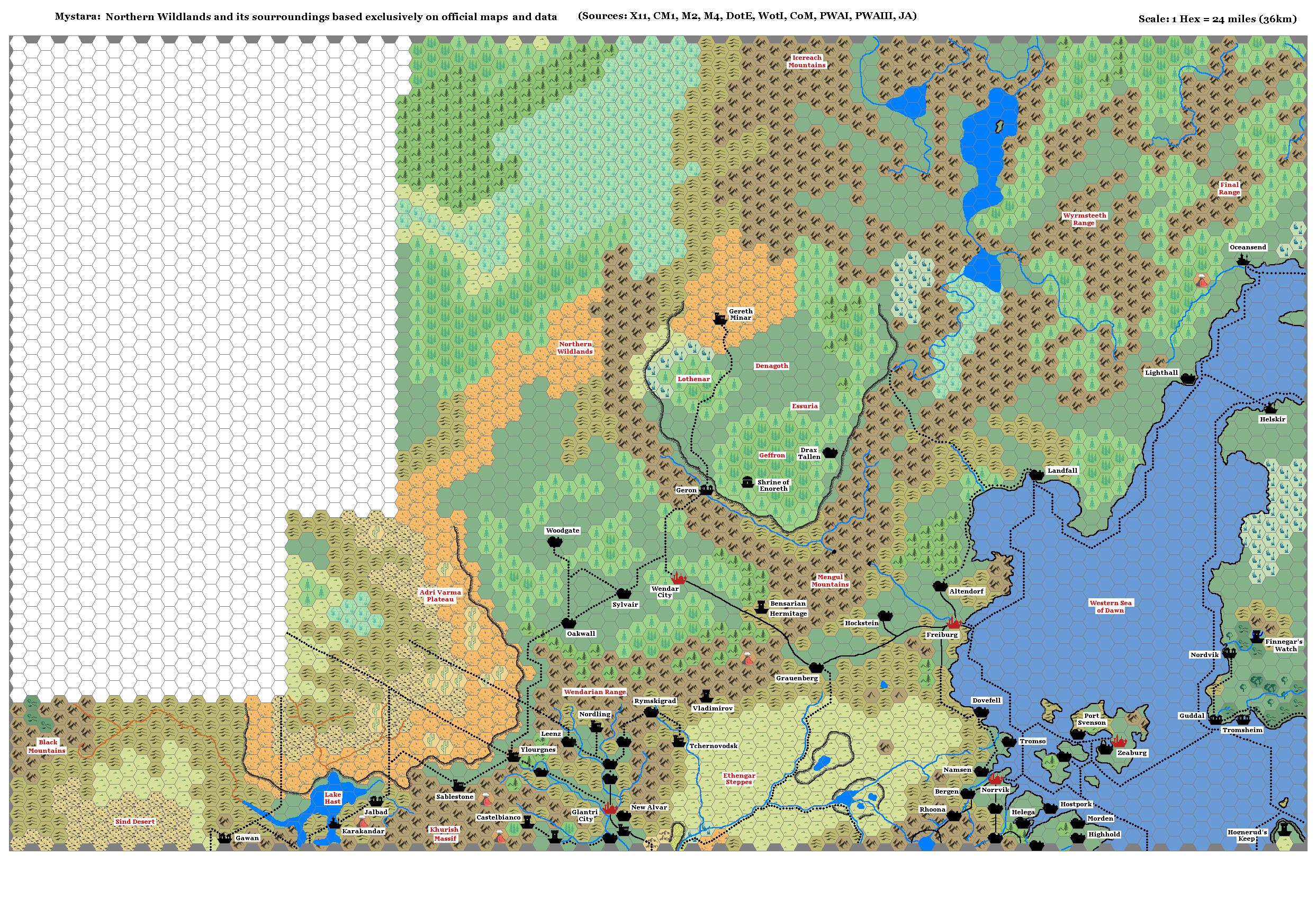
This map is not exactly correct (for example, the IoD should be moved about 1 hex SW), but everything inside is showed at least once in some official map. I hope it helps. I added the town of Lighthall from M4, considering the info given herein (on the coastline, halfway between Oceansend and Landfall: I chose a cape where the Landfall-Oceansend route intersects the Landfall-Helskir route; this should be a very strategic point to build a city.)
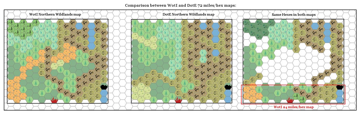
To help explaining my choices about northern wildlands hexes, here is a comparison between DotE and WotI maps (I reported WotI map to a 72 miles/hex scale to help comparison), the only two maps that show this region:
In the Italian Message Board we are currently thinking about locating Ghyr kingdom in the Northeastern tip of Denagothian plateau, in the area immediately west of the swamp.
In such a way we have that Ghyr is located in the eastern side of the Icereach Mountains (instead of the western side), but we preferred this location because it seemed more geographically suitable: we estimated that the map showed in XL1 shouldn't be more than 50 miles across. Moreover, we know that Ghyr is connected to the sea (due to a sponges load robbed from a caravan and stored in Danhakriss dungeon).
We are thinking also about having Ghyr as an offshoot of some Essuria's province when this kingdom was at its height.
For the sake of convenience we placed Ghyr's kingdom and XL1 events in the present era (AC950-1000), instead of AC1200, due to the presence of Figgen's retirement estate in the Ierendi archipelago described in GAZ4. Figgen was the halfling who joined Mercion, Strongheart and the others in the Quest for the Heartstone of XL1 module.