Rio Copos
by Átila Pires dos SantosI'm going to DM a Mystaran pbem at the SC c. 900 AC (it's a Portuguese pbem, but everyone are invited, I can translate actions into Portuguese if needed) and I need a map for the region for this period. And thus, I started mapping...
Then, I got to the old Great Escarpment problem, and decided to use VotPA as the "most canon" source, since RS have indeed a LOT of mistakes and odd things... anyway, I plan to use most of RS references as possible: Vastrovek is just there south Kastr; Narvich, Bukovosko and Brugzol might be out there, at the Konumtali Savanna; Sandros Valley is that valley just north Sevlievo; and Mt. Hupluk could well be that volcano north of Kosovsko.
Anyway, the biggest problem was (and still is) Rio Copos, since it cuts the Highlands of the Pycts in two, in the first place, and even VotPA regional maps (Robrenn and Eusdria) disagree about where it splits.
I tried to conciliate VotPA, RS, X5 and used much of Thorf's interpretation of RS maps (and also used many of Thibault's)
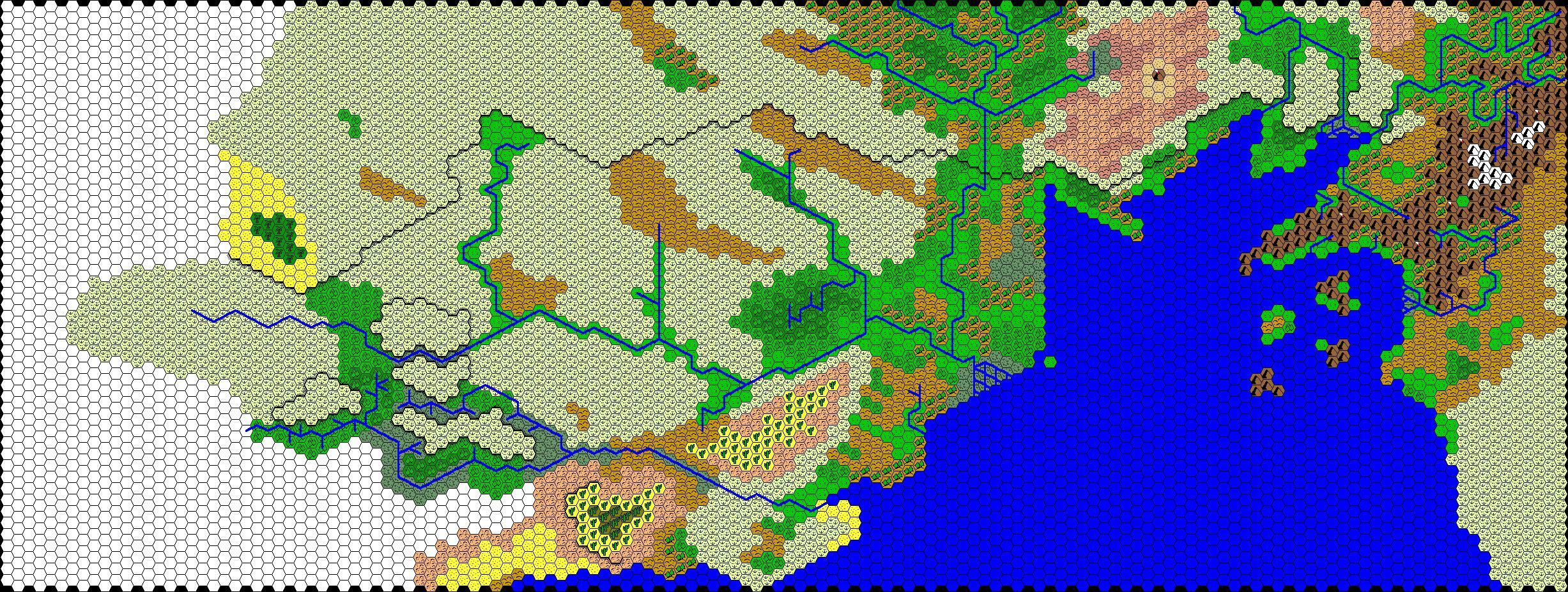
That's the final result:
Updated version, including Adamantyr's red hills at Terra Vermelha
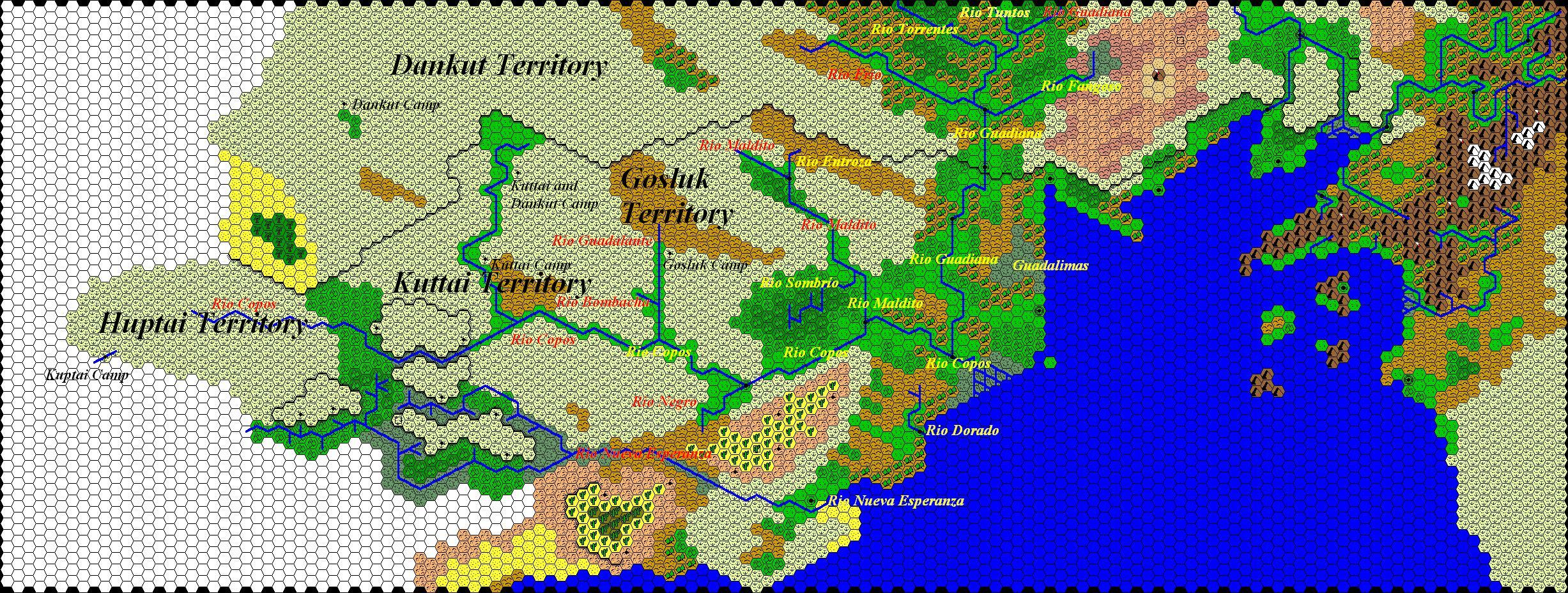
I labelled the Yazak camps and territories, according to this new SC map, considering Rio Copos as it should be (note that "Dankut Camp" and "Kuttai and Dankut Camp" were reversed)
Rivers are also labelled, and I made up some names for unnamed rivers:
-Rio Guadalante
-Rio Bombacha
-Rio Entroza (because of the Baronía de Entroza; it's capital, Ciudad Nacional, is marked at the map too)
-Rio Sombrío
-Rio Dorado (because of Paso Dorado)
Also added a fertile valley at the end of the still unnamed river, that joins Rio Copos
And that's the same map, without labels: