
Selenica city map
by Robin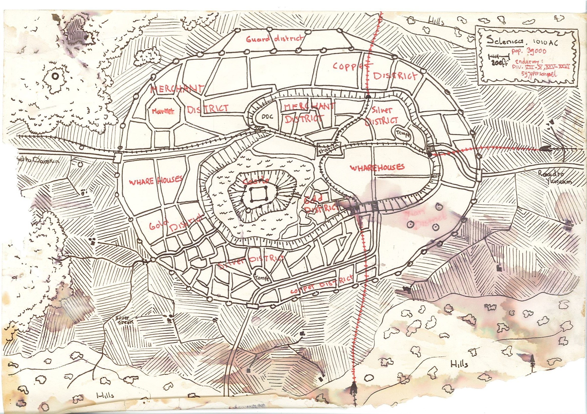
the red blur with 3 minor cicles is the ylari district. the three circles are minaret style mage towers, from ylari mages chased out of ylaruam, but welcomed in darokin.
the train tracks are those i used in my earlier research of the Dwarven Thane
the final works can be found here Dwarven Thane
the red train tracks are tunnels. both tracks meet at the station, but actually never cross.
selenica lies in a doline with a central rock, which centuries ago(before the age of Nithia) did collapse. the lake around the rock upon selenica castle lies (also a mark of a long bygone era, a remnant of the old doulakki culture here), but now it has become the official district, the local government so to say.
the average city lies at a height of 35'above the water, and the rock a 40 feet above that.. the lower grasslands lie aboutthe same height as average selenica, the southern and NE hills go up 100'per line passed. the lake is 150'deep, and never lowewrs or rises its water level, as if it is connected below with an enourmous water system callibrating it.
the train tunnels coming frome elsewhere are open in the hills, but slowly dive down in the ground to submerge again at the lower placed station.
the forests are minor, more bush/platation style. as the Canolbarth Forest is further away see the map here East Canolbarth Forest.
The single circle West is a mage tower , allowed to take up residence there, heavily checked and controlled, and probably working for the government. The owner is a mage of minimum 45 years of age and 15th level according Gaz Darokin.