
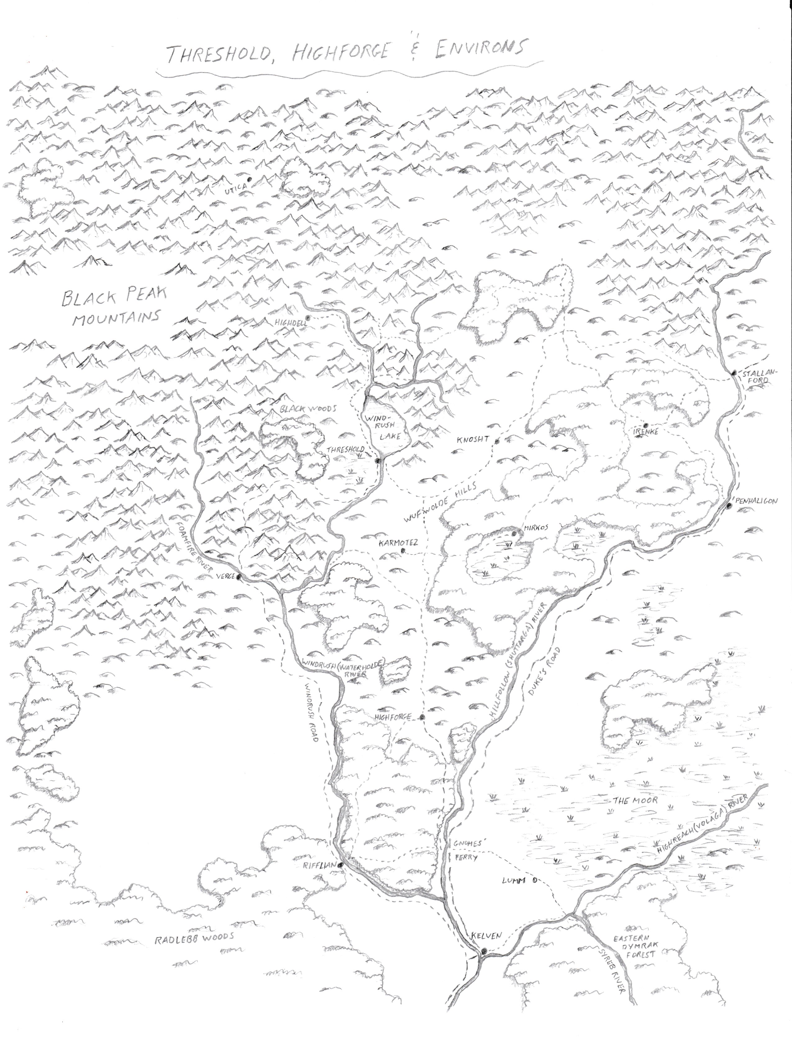
Map of Threshold, Highforge, & Environs
by Sheldon MorrisHere's the hand drawn map that I mentioned in another thread that I was working on. It is based on these two maps on The Vaults: map 1, map 2.
Some notes about it though -
This certainly was a learning map for me. I had done some maps many years ago and found myself rediscovering and developing new techniques. In fact, I went back over some parts many times as I refined how I did things to 'update' it to the new method and look. So it isn't the greatest map but I'm still pretty proud of it.
Since this map is for my current campaign it also has non-canon sites on it; namely Karmotez and Mirkos. These are villages (renamed) from the 5E Starter Set adventure.
Finally, I really found myself struggling on how to show forested hills from the source maps. I kept wondering, since I had decided to only show 'heavy' forest as forests, whether to show forested hills as forests or hills. So I compromised and "just did something" to finish the map. And that's why it looks like it does.
I hope you like and feel free to use it and modify it if you want to.
PS Just realized I forgot to put the scale on it before I scanned it. At the "original" size (~8.5"x11"), it should be about 8 miles per inch.