
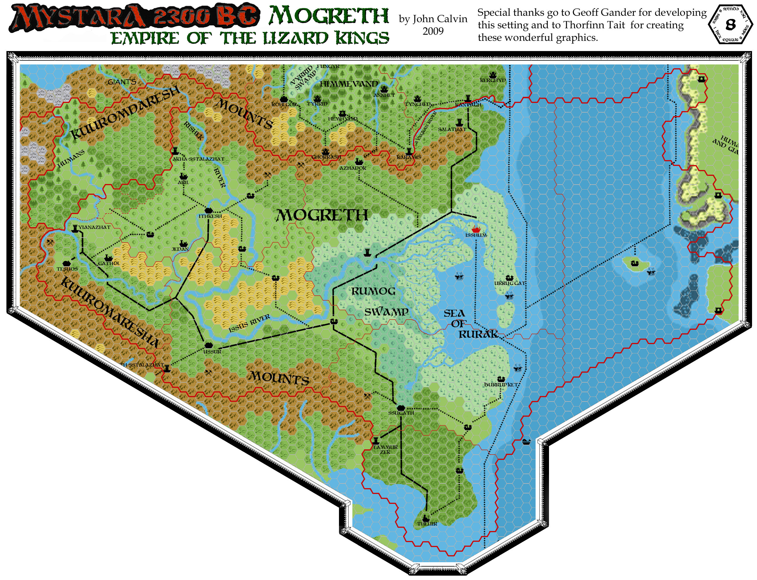
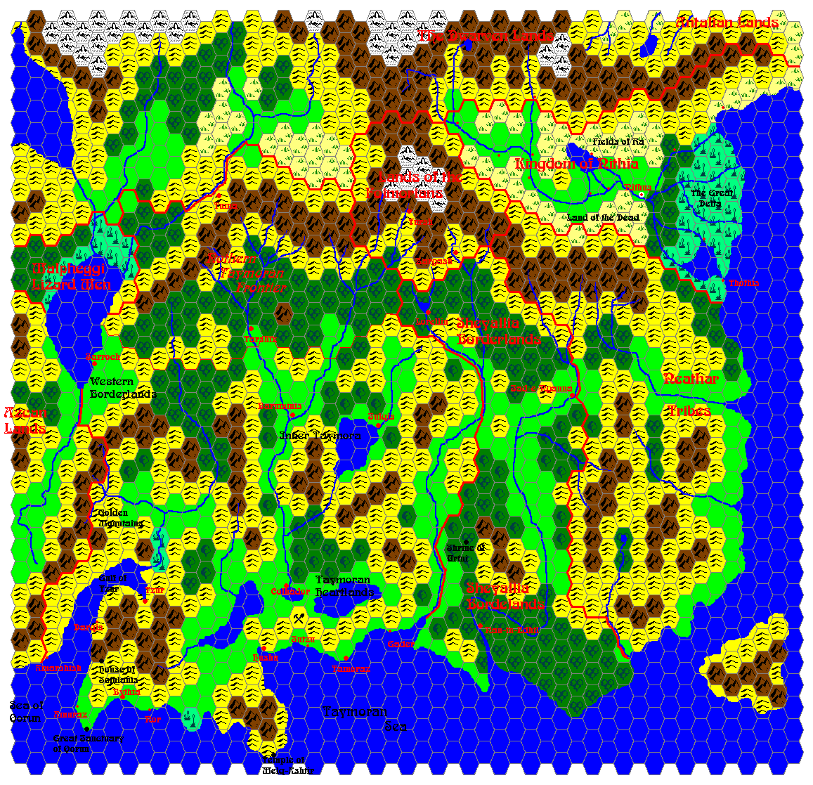
Mogreth 2300 BC, 8 miles per hex
by John CalvinMaps
Map of Mogreth, 8 miles per hex by John Calvin, August 2009 (Work In Progress)


Map of Mogreth, CC3 by John Calvin, August 2010 (Work In Progress)

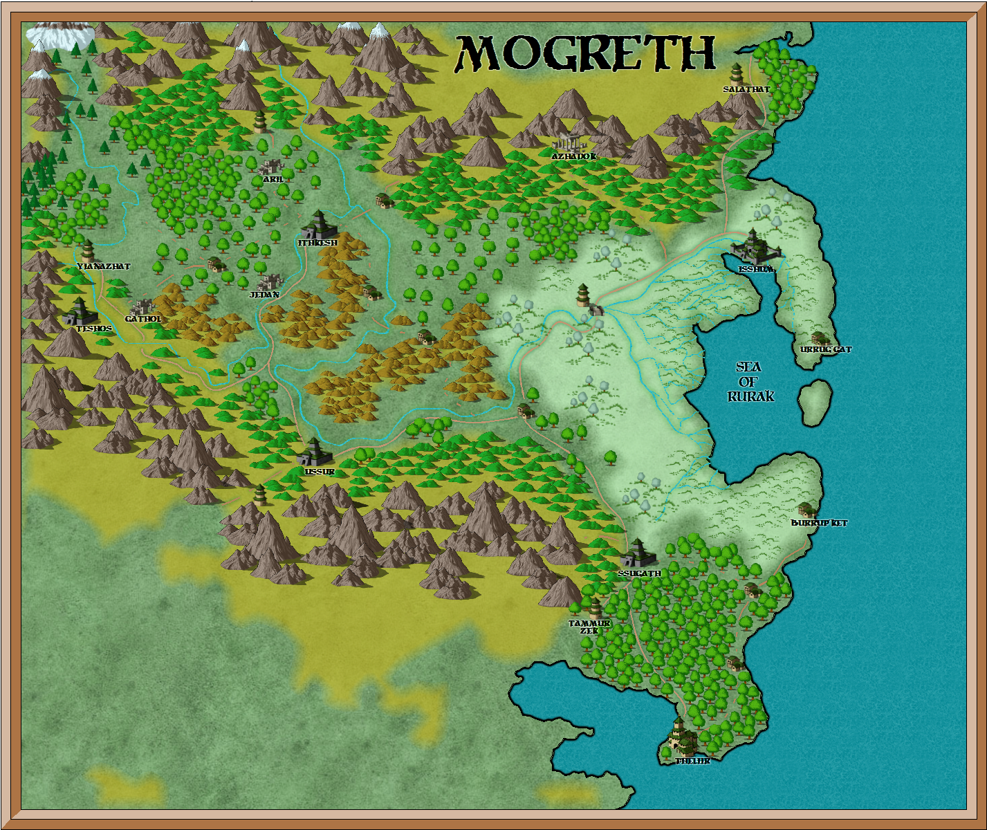
Map of Mogreth (Mystaran Map Colors), CC3 by John Calvin, August 2010 (Work In Progress)

Comments
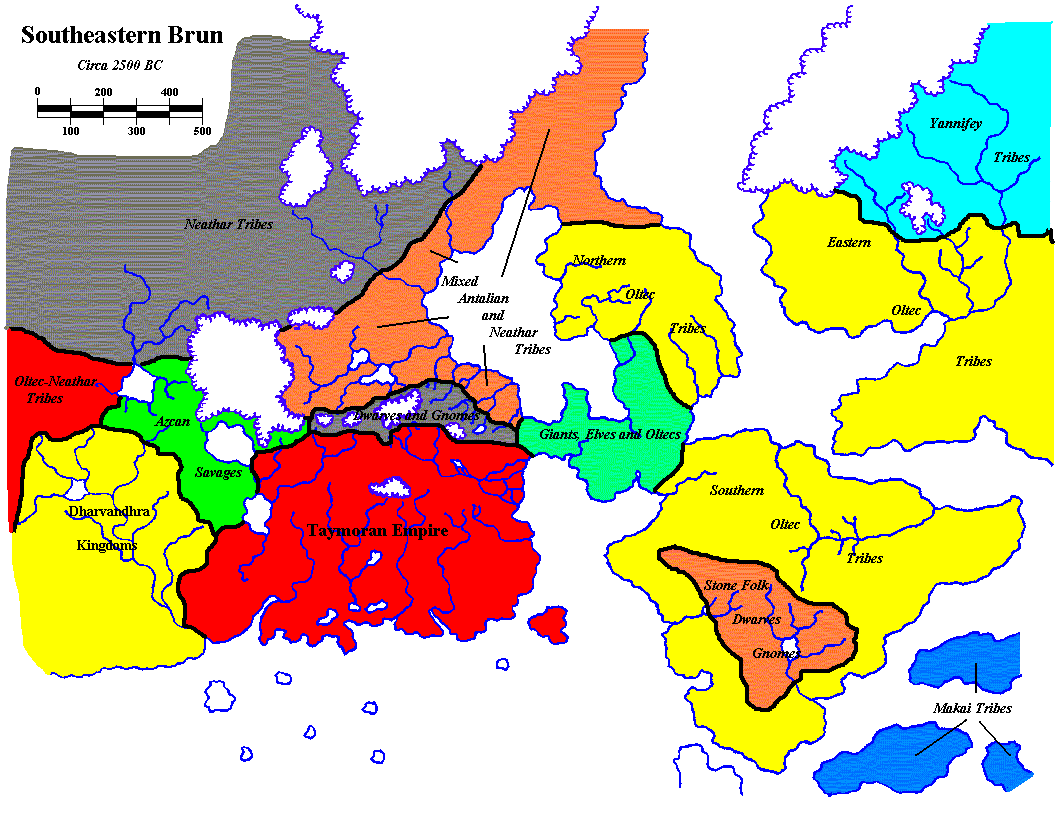
This map of Mogreth in 2300 BC covers areas of current day (1000 AC) Ylaruam, portions of the Northern Reaches, Thyatis, and the Isle of Dawn, as well as lands that sunk beneath the sea in 1700 BC.
Sources:
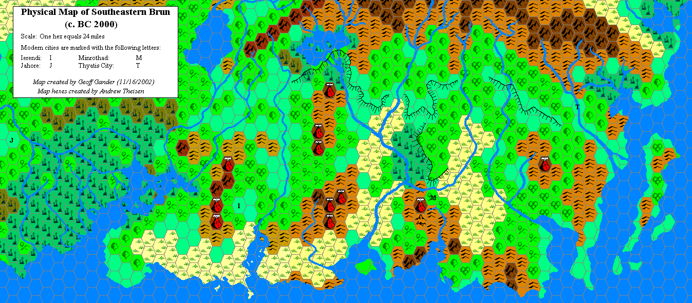
Unofficial Maps: Taymor at the Vaults of Pandius, Physical Map of Southeastern Brun (c. BC 2000) (2002) by Geoff Gander, Map of Taymora (2003) by James Mishler, Map of Southeastern Brun: 2500 BC (2003) by James Mishler, Geopolitical map of Taymora (2004) by Giampaolo Agosta, Taymora BC 2300 by John Calvin, Taymora BC 2300 with cities by John Calvin.
Notes on XXX
To Do List
- Continue to name all major geographical features.
References
Thanks to: Thorfinn Tait, for providing some wonderful graphics to use in all of our mapping projects, and Geoff Gander for developing Mogreth. Thanks to Hugin, happylarry, and Ashtagon for providing input in developing this map.